
WEST PEAK OF OTTFJÄLLET


The original plan for the weekend was to go sailing with Vera. However, with gale-force winds predicted in the Stockholm archipelago, I had to rethink things. Instead, I strapped a bed to the roof of the car and headed up to Åre to build a loft bed in the cabin. The weather forecast here didn’t look much better, with rain on the way, but the forecast was wrong—there was actually a fair amount of sunshine too! After a morning of carpentry, I found myself with a few free hours and decided to lace up my running shoes.
A couple of years ago, some friends and I hiked up Ottfjället, and it became one of those unforgettable days. We summited the eastern peak then, which is the highest and the most popular route. Today, I opted to run up the western peak instead, which is a bit lower at 1222 meters above sea level. The first few kilometers are the same as the trail to the eastern peak, featuring a rocky path that demands your full attention to keep your footing!


The trail then ascended sharply through a stunning valley, lined with streams and boardwalks. It was steep and rocky in sections, so I ended up walking quite a bit to navigate the terrain.
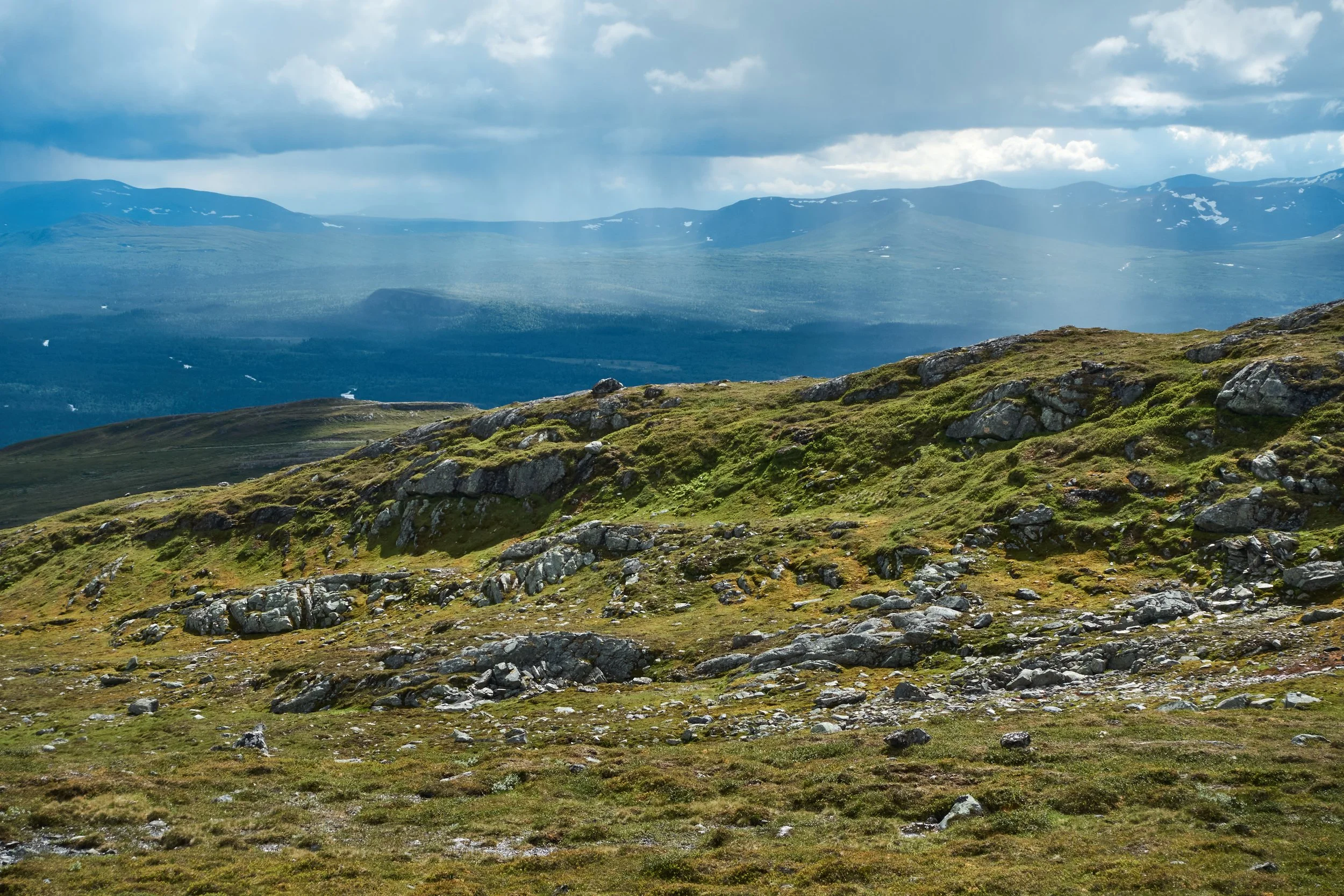


The rain was pouring down on the horizon, but I only caught a few drops. As I climbed higher, though, the wind picked up, and eventually, I had to pull on a wind jacket to keep warm.

After a few more kilometers, I reached a plateau that offered truly breathtaking views. The sun made occasional appearances, lighting up the stunning scenery, and the views were simply magical.
But then, quite strangely, the trail started descending again. I had downloaded a route from Åre Trails that morning, and I had naturally assumed it would take me to the summit of the western peak. However, the route ended in a valley by a small lake, partially covered in snow. It was a bit disappointing that the trail didn’t lead to the top, but at least it brought me to a stunningly beautiful spot. So, I took out my coffee and a couple of sandwiches and paused for a little fika by the lake.

Today, I tried out my new backpack from Ultimate Direction. The model, which is just over 20 liters, is called SCRAM, standing for Skiing, Climbing, Running, And More, and it’s designed to be versatile for a variety of activities. It felt really comfortable to run with, though the shoulder straps rubbed a bit against my collarbones, but I’m sure that can be adjusted. After the fika, it was time to head back, and I retraced my steps the same way I came.


On the way back, I couldn’t help but feel more and more tempted to run up to the highest, eastern peak. However, when I reached the point where the trail split, a sudden shower hit, and the wind picked up significantly. So, I decided to turn back toward Vålådalen instead. It was also getting close to 5 p.m., and I still had about 1.5 hours to get home, including the drive.

It turned out to be an amazing first mountain run, covering 13.3 km and 681 meters of elevation. I was a bit worried that my Achilles tendon might act up during the run, but it felt really great, knock on wood.
